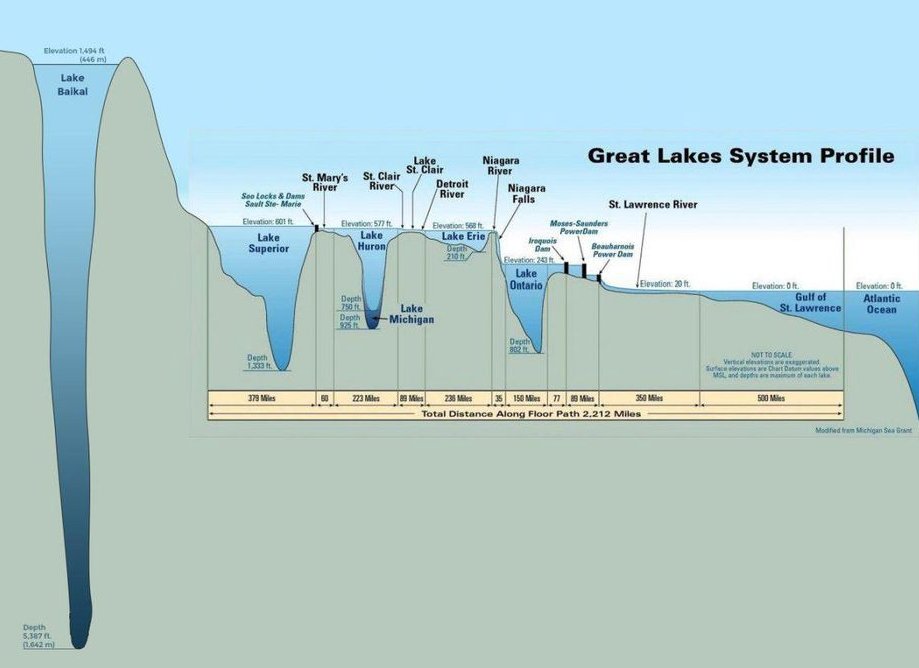
Lake Baikal Dwarfs the Great Lakes Combined
A Great Lakes elevation profile with Russia's Lake Baikal added at left, showing how its 5,387 ft depth dwarfs every Great Lake. A science class geography flashback.
Image description
Cross-section diagram titled "Great Lakes System Profile" with a very deep, narrow Lake Baikal on the left, elevation 1,494 ft (446 m), depth 5,387 ft (1,642 m), beside the Great Lakes, labeled Superior, Huron, Michigan, Erie, Ontario, St. Lawrence River, Gulf of St. Lawrence, Atlantic Ocean.




Comments
No comments yet. Start the thread.
Log in to comment and save favorites.