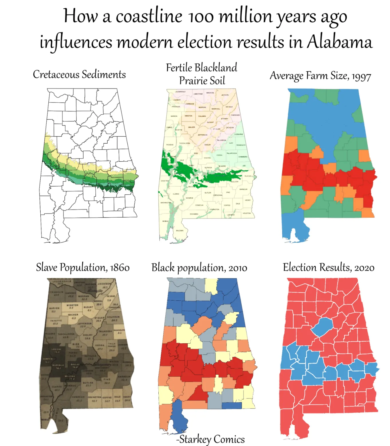
Cretaceous Coastline Still Picks Alabama's Election Results
A map series links Alabama's Cretaceous coastline to Blackland Prairie soil, big farms, 1860 slavery, Black population and 2020 votes. Social studies class, grown-up edition.
Image description
Six maps of Alabama in two rows. Title: "How a coastline 100 million years ago influences modern election results in Alabama". Top row: "Cretaceous Sediments" with a green band across the south; "Fertile Blackland Prairie Soil"; "Average Farm Size, 1997". Bottom row: "Slave Population, 1860"; "Black population, 2010"; "Election Results, 2020". Credit: "-Starkey Comics".

Comments
No comments yet. Start the thread.
Log in to comment and save favorites.