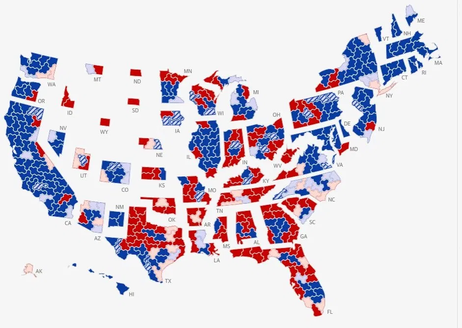
Midterm Results Map, Every State Pulled Apart
A district-level 2026 midterm election results map with states pulled apart, a civics class flashback for Xennials who learned red and blue states from pull-down classroom maps.
Image description
Map of the US with each state separated by white gaps and split into red and blue districts, some pale or hatched. Each state carries its two-letter label, such as WA, TX, CA, FL, NY and AK. Alaska and Hawaii sit at lower left.





Comments
No comments yet. Start the thread.
Log in to comment and save favorites.